Shelby Wu November 9, 2026
If you live in or near Woodbridge, changes to Yale Avenue and Yale Loop could affect how you drive, park, walk, and bike in your own neighborhood. The City of Irvine held a virtual workshop on October 14, 2026 to share early ideas and collect feedback. Here is a plain-language summary of what was shown, what concerns have been raised, and how you can weigh in.
One important note first: the City stressed that everything in the presentation is a concept for community discussion, not a specific proposal or final plan.
The Yale Avenue Enhancement Project runs along Yale Avenue from the I-405 freeway to Portola Parkway, and includes West and East Yale Loop. The City says the goal is to improve safety, accessibility, and mobility for people who walk, bike, drive, and use transit. The project grew out of the City's 2024 Sustainable Mobility Plan and its 2021 Strategic Active Transportation Plan.
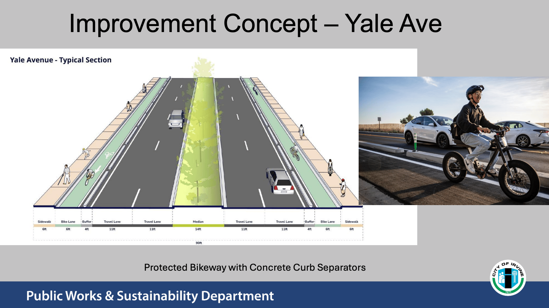
Yale Avenue: A typical section with a 6-foot bike lane and 4-foot buffer on each side, protected by concrete curb separators. Two 11-foot travel lanes in each direction and a 14-foot landscaped median remain in the concept.
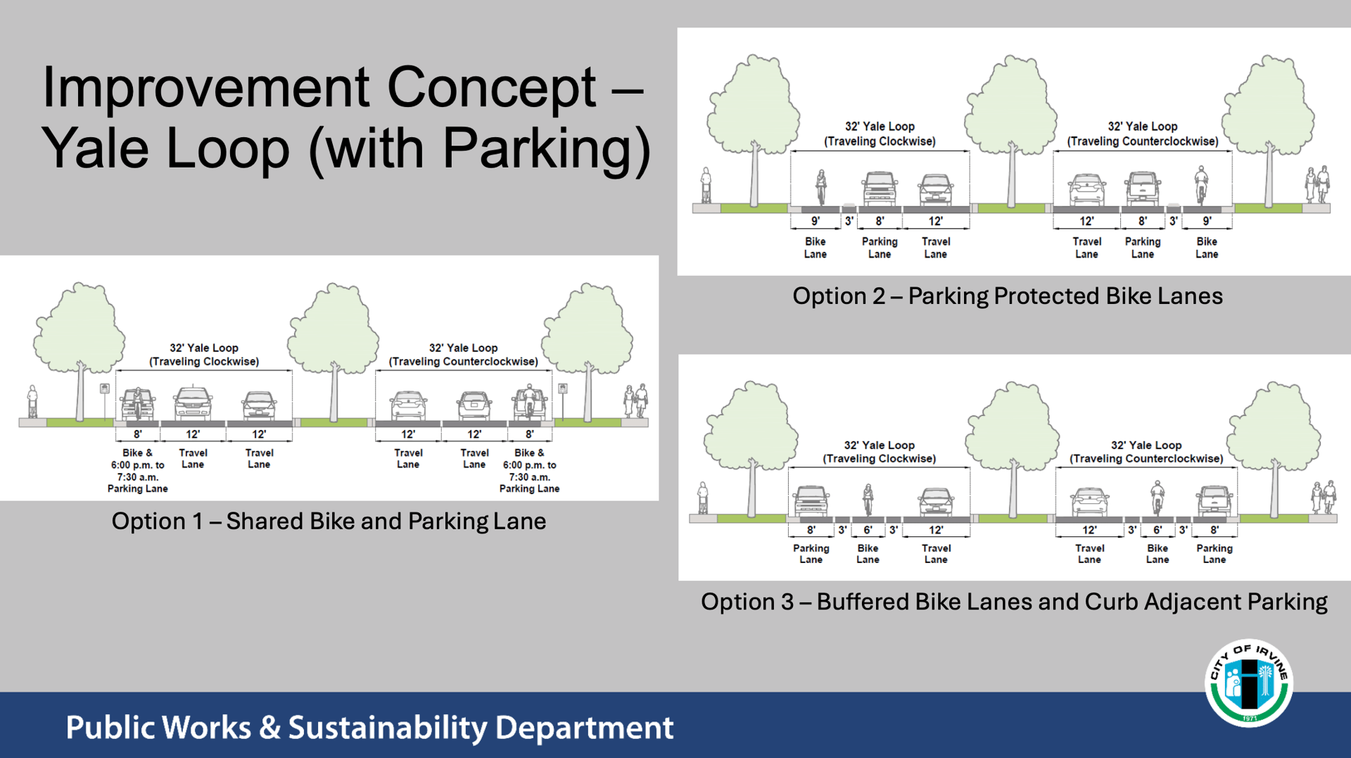
Yale Loop (with parking): Three options. Option 1 is a shared bike and parking lane, where parking is allowed from 6:00 p.m. to 7:30 a.m. Option 2 places bike lanes next to the curb with parked cars acting as protection. Option 3 uses buffered bike lanes with parking along the curb. Options 2 and 3 show one travel lane per direction, which lines up with the Woodbridge Village Association's note that the study could convert a second traffic lane to parking.
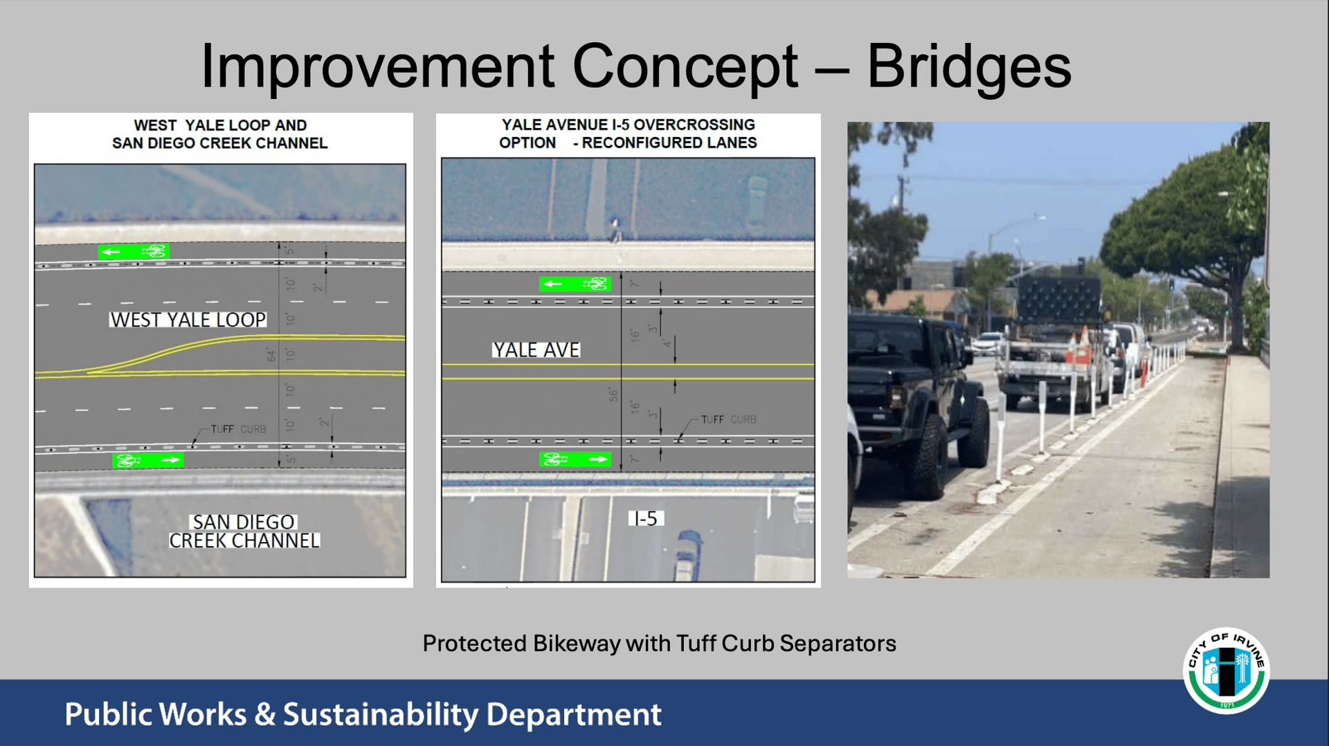
Bridges: Protected bikeways with flexible "tuff curb" separators at the West Yale Loop and San Diego Creek crossing and at the Yale Avenue overpass above I-5, using reconfigured lanes.
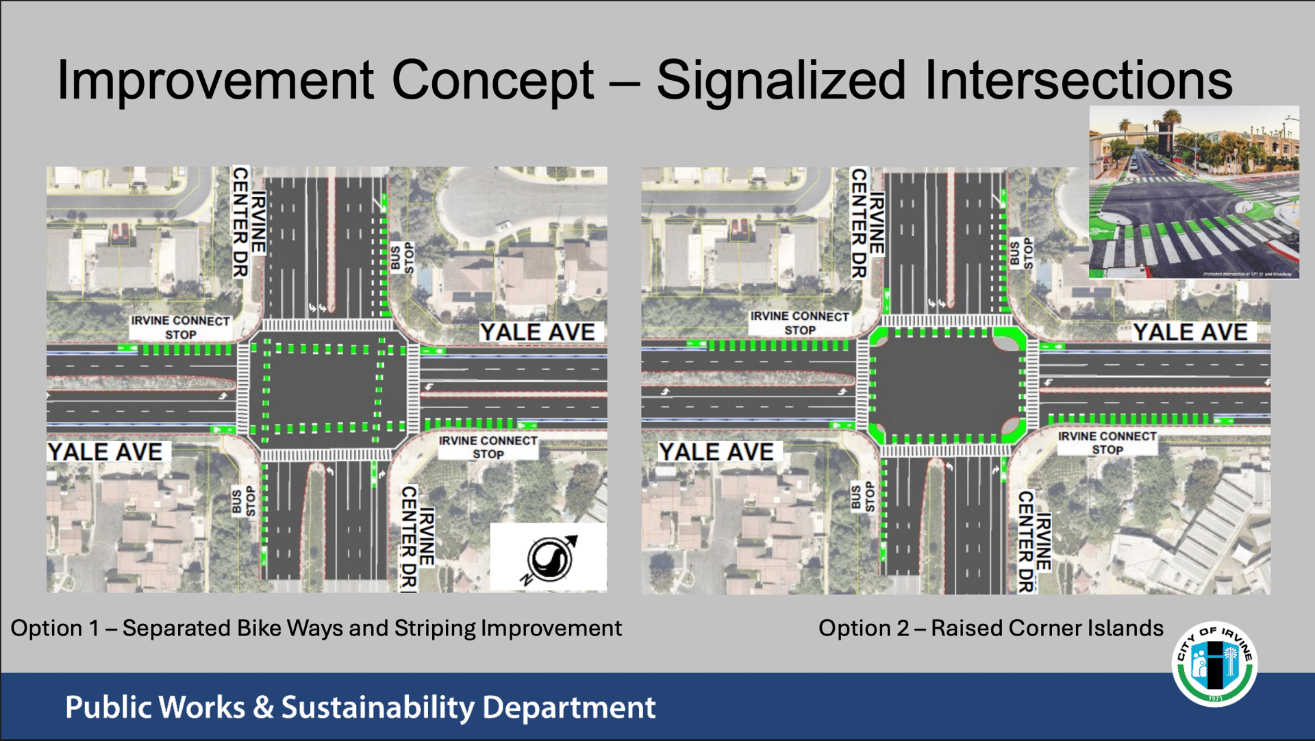
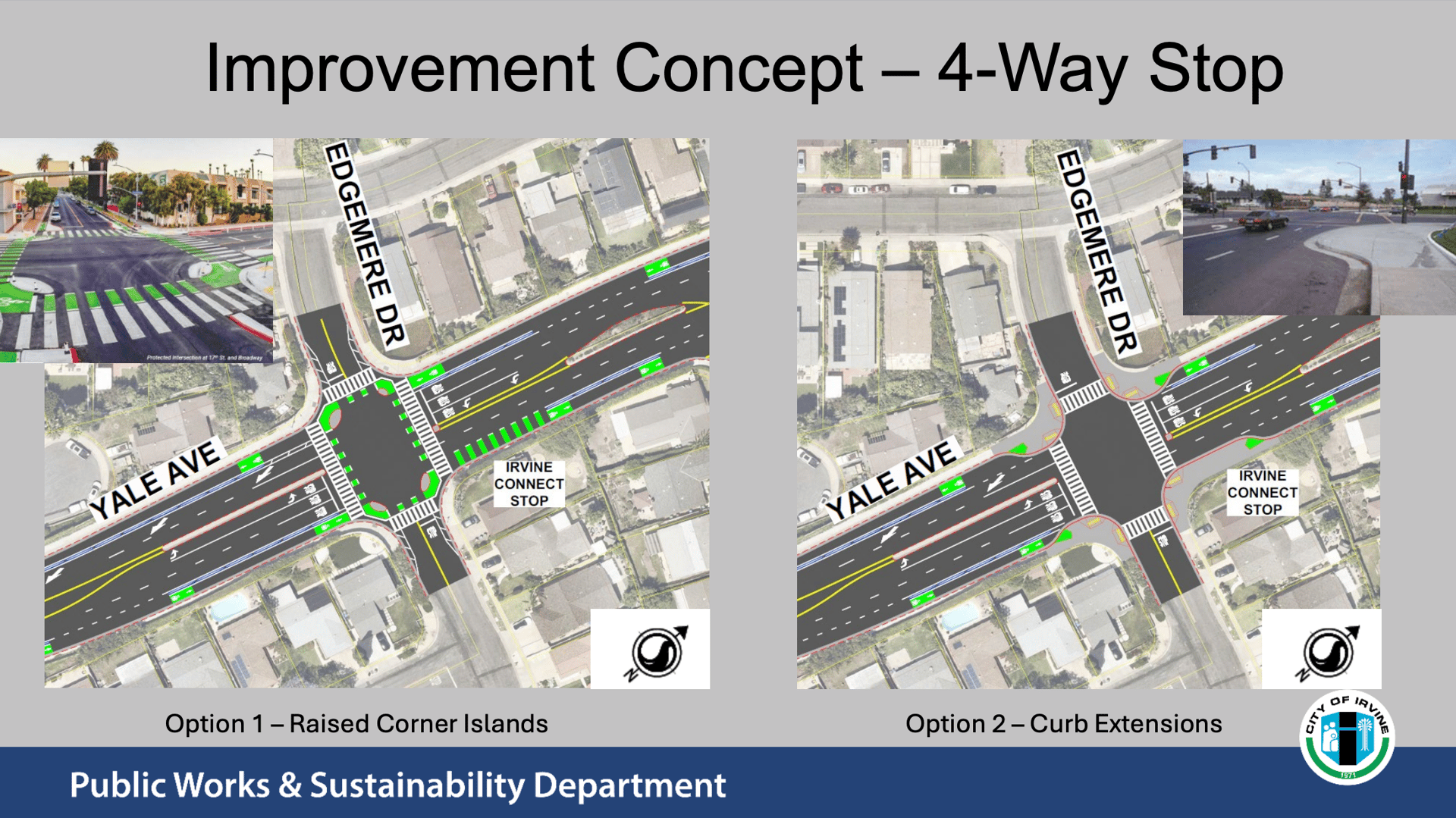
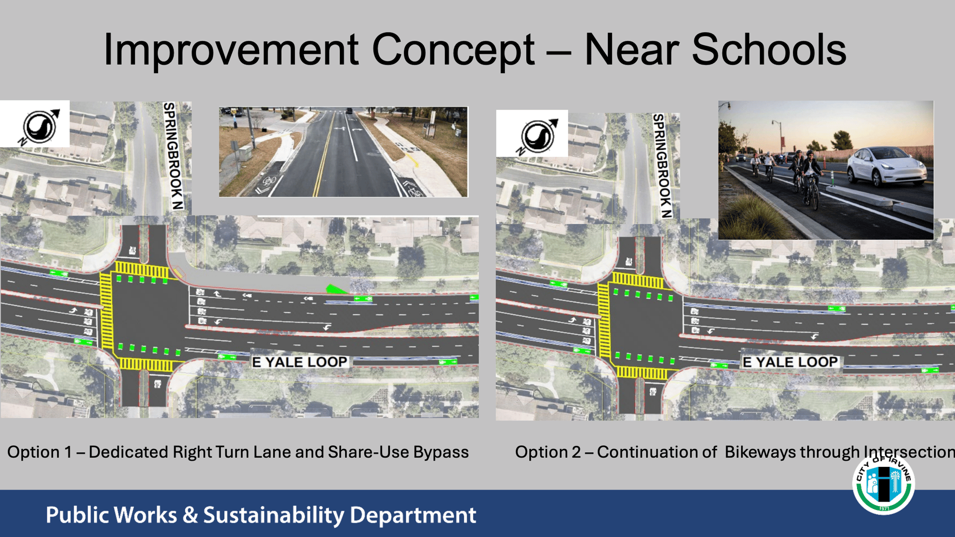
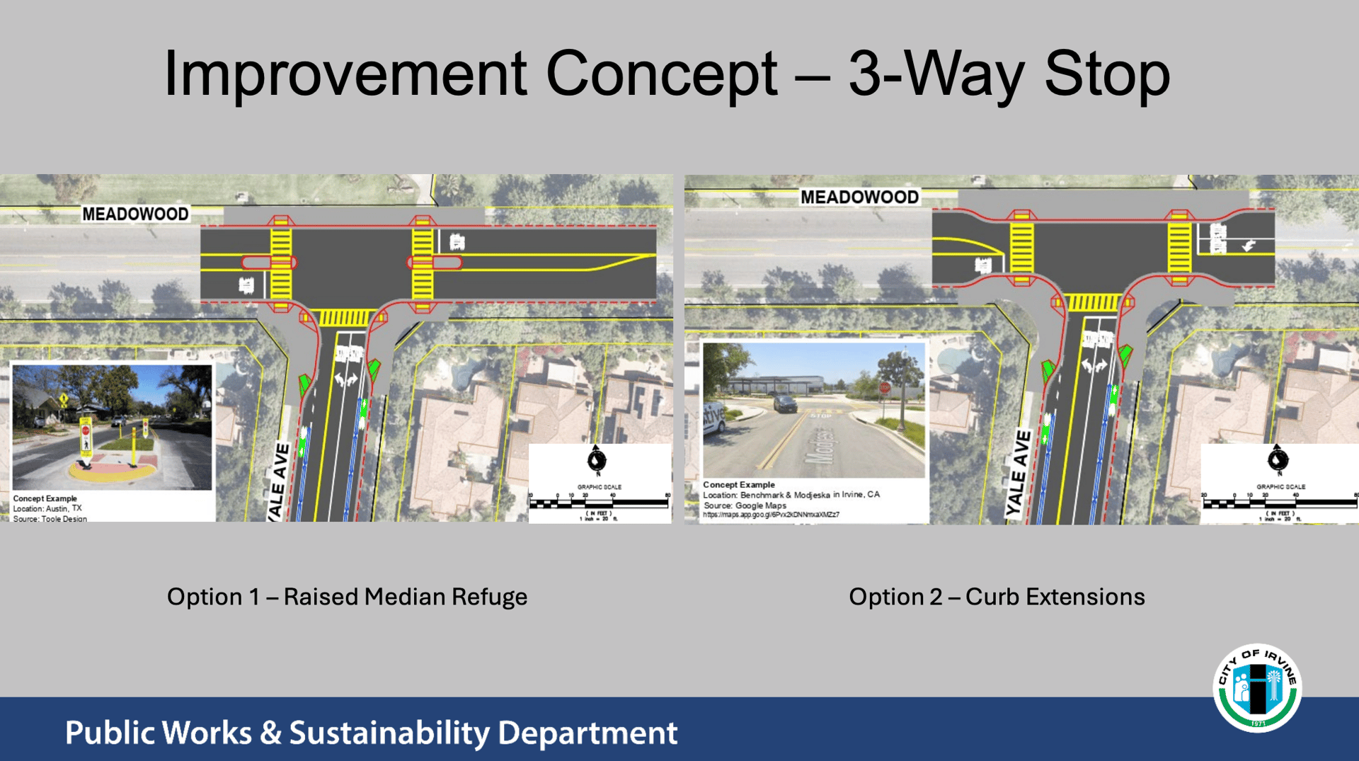
Intersections: Signalized intersections, 4-way stops, 3-way stops, and school-area crossings each show two options, such as raised corner islands, curb extensions, a raised median refuge, a dedicated right-turn lane with a shared bypass, or bikeways that continue through the intersection.
Of 59 workshop attendees, 51 answered a poll on how they travel the Yale corridor. Ninety-six percent said they drive, 57 percent walk, run, or jog, 39 percent bike for fun or sport, and 8 percent bike to work or school. Attendees could select more than one answer, and a small virtual sample does not necessarily represent the whole community.
The City's fact sheet points to safer and more connected travel for everyone, new and improved bike lanes, better trail connections, and separating bicyclists from pedestrians. Supporters of protected bikeways generally argue that physical separation from traffic makes cycling safer and more comfortable for families, students, and riders on e-bikes.
We were not able to find published public comments specific to this north-of-405 project yet, since feedback is still being collected. The closest documented disagreement comes from the City's neighboring South Yale Corridor project, which uses a similar curb-separated bikeway approach. Those concerns give a preview of what neighbors may raise here:
Existing lanes already work. The Bicycle Club of Irvine declined to write a letter of support for the South Yale plan, saying the current wide bike lanes meet or exceed standards and that narrower, curb-protected lanes could make it harder for cyclists to merge into traffic.
Protected lanes are not always used. The club also pointed out that curb-separated bikeways are not mandatory for cyclists, so some riders may stay in the traffic lane and frustrate drivers.
Priorities and cost. Residents commenting online this spring questioned whether the expense is justified, noting the City's budget, and suggested lower-cost fixes such as a lower speed limit, a speed bump, an added crosswalk, or daytime street parking. Others preferred better pavement, consistent lane markings, or roundabouts.
For Woodbridge specifically, the open questions are likely to center on trade-offs the concepts themselves show: what happens to street parking and traffic flow on Yale Loop, how well the intersection options work near schools, and how much the project will cost and when construction would affect daily routines.
The City plans a second phase of community outreach in winter and spring 2027, followed by selecting a preferred alternative, completing a preliminary study and environmental review in summer 2027, starting final design in fall 2027, and beginning construction around winter 2028 to 2029.
Whether you support the concepts, have concerns, or are somewhere in the middle, this is the stage where feedback matters most. We would like to hear how you feel about the proposed changes to Yale Avenue and Yale Loop. Are protected bike lanes worth trading some parking or travel lanes? Which intersection options make the most sense for your street?
Share your thoughts with us at [email protected] or 949.385.3596. You can also give feedback directly to the City through the project page at cityofirvine.gov/mobility-improvement-projects or by emailing Wendy Wang, the City contact listed in the presentation, at [email protected].
Stay up to date on the latest real estate trends.
Irvine is studying protected bike lanes, parking changes, and safer crossings on Yale Avenue and Yale Loop. See the concepts, the concerns, and share your view.
Rates are above 7% and Irvine homes are taking longer to sell. See September 2026 Irvine and Orange County stats and what they mean for you.


Irvine Real Estate Market Update
See the latest Irvine real estate market data for June 2026 — median prices, days on market, and inventory trends for condos and single-family homes, compared to Orang… Read more

Etiam non quam lacus suspendisse faucibus interdum. Orci ac auctor augue mauris augue neque. Bibendum at varius vel pharetra. Viverra orci sagittis eu volutpat.